 vesseltracker.com
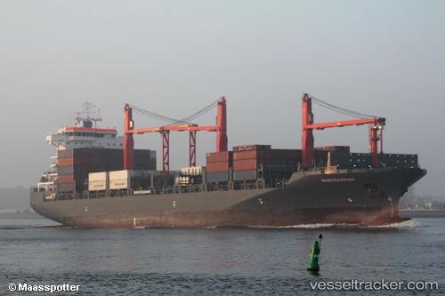
Vessel 'MAERSK BAHAMAS' IMO: 9697026, MMSI: 563096500
UTC, 29.93495, 121.87181, course: 291, speed: 0
UTC, 29.93496, 121.87174, course: 291, speed: 0
2026-02-19 19:49:02 UTC, 29.93498, 121.87178, course: 290, speed: 0
Live AIS position:
UTC. Near Beilun),
updated 2026-02-19 19:49:02 UTC.
Find the position of the vessel 'MAERSK BAHAMAS' on the map. The latter are known coordinates and path.
marine traffic ship tracker show on live map
The current position of vessel 'MAERSK BAHAMAS' is 29.93498 lat / 121.87178 lng. Updated: 2026-02-19 19:49:02 UTCDetails:
Last coordinates of the vessel:
UTC, 29.93494, 121.87183, course: 291, speed: 0UTC, 29.93495, 121.87181, course: 291, speed: 0
UTC, 29.93496, 121.87174, course: 291, speed: 0
2026-02-19 19:49:02 UTC, 29.93498, 121.87178, course: 290, speed: 0