 vesseltracker.com
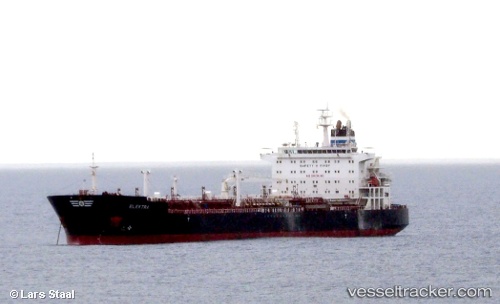
Vessel VIALLI IMO: 9538153, MMSI: 563167300 Chemical/Oil Products Tanker
UTC, -25.48833, -48.44667, course: -1, speed: 0
UTC, -25.48923, -48.45044, course: 142, speed: 0.4
2026-02-09 17:38:18 UTC, -25.49030, -48.45104, course: 88, speed: 0.1
Live AIS position:
UTC. Near Paranagua),
updated 2026-02-09 17:38:18 UTC.
Find the position of the vessel VIALLI on the map. The latter are known coordinates and path.
marine traffic ship tracker show on live map
The current position of vessel VIALLI is -25.49030 lat / -48.45104 lng. Updated: 2026-02-09 17:38:18 UTCCurrently sailing under the flag of Singapore
VIALLI built in 2012 year
Deadweight:
52422 tDetails:
Last coordinates of the vessel:
UTC, -25.50113, -48.53350, course: 255, speed: 0UTC, -25.48833, -48.44667, course: -1, speed: 0
UTC, -25.48923, -48.45044, course: 142, speed: 0.4
2026-02-09 17:38:18 UTC, -25.49030, -48.45104, course: 88, speed: 0.1