 vesseltracker.com
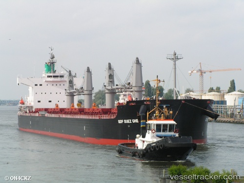
Vessel SHARK ISLAND IMO: 9520924, MMSI: 563310600 Bulk Carrier
UTC, 46.82842, -71.20128, course: 57, speed: 0
UTC, 46.82841, -71.20127, course: 57, speed: 0
2026-02-25 21:27:53 UTC, 46.82841, -71.20123, course: 57, speed: 0
Live AIS position:
UTC. Near QUEBEC),
updated 2026-02-25 21:27:53 UTC.
Find the position of the vessel SHARK ISLAND on the map. The latter are known coordinates and path.
marine traffic ship tracker show on live map
The current position of vessel SHARK ISLAND is 46.82841 lat / -71.20123 lng. Updated: 2026-02-25 21:27:53 UTCCurrently sailing under the flag of Singapore
Details:
Last coordinates of the vessel:
UTC, 46.82842, -71.20130, course: 58, speed: 0UTC, 46.82842, -71.20128, course: 57, speed: 0
UTC, 46.82841, -71.20127, course: 57, speed: 0
2026-02-25 21:27:53 UTC, 46.82841, -71.20123, course: 57, speed: 0