 vesseltracker.com
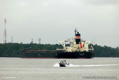
Vessel Tenryu Maru IMO: 9727170, MMSI: 564121000 Bulk Carrier
UTC, -23.83162, 151.45872, course: 108, speed: 0.5
UTC, -23.83188, 151.45857, course: 81, speed: 0.3
2026-02-05 13:35:16 UTC, -23.83062, 151.45900, course: 131, speed: 0.4
Live AIS position:
UTC. Near Boyne Island),
updated 2026-02-05 13:35:16 UTC.
Find the position of the vessel Tenryu Maru on the map. The latter are known coordinates and path.
marine traffic ship tracker show on live map
The current position of vessel Tenryu Maru is -23.83062 lat / 151.45900 lng. Updated: 2026-02-05 13:35:16 UTCCurrently sailing under the flag of Singapore
Details:
Last coordinates of the vessel:
UTC, -23.83096, 151.45863, course: 111, speed: 0.2UTC, -23.83162, 151.45872, course: 108, speed: 0.5
UTC, -23.83188, 151.45857, course: 81, speed: 0.3
2026-02-05 13:35:16 UTC, -23.83062, 151.45900, course: 131, speed: 0.4