 vesseltracker.com
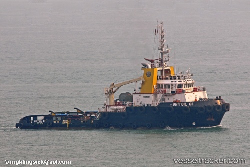
Vessel Britoil 61 IMO: 9375537, MMSI: 564162000 Offshore Tug Supply Ship
UTC, 25.46833, 55.50667, course: -1, speed: 0
UTC, 25.46833, 55.50667, course: -1, speed: 0
2026-01-15 00:09:36 UTC, 25.46833, 55.50667, course: -1, speed: 0
Live AIS position:
UTC. Near Al Hamriyah),
updated 2026-01-15 00:09:36 UTC.
Find the position of the vessel Britoil 61 on the map. The latter are known coordinates and path.
marine traffic ship tracker show on live map
The current position of vessel Britoil 61 is 25.46833 lat / 55.50667 lng. Updated: 2026-01-15 00:09:36 UTCDetails:
Last coordinates of the vessel:
UTC, 25.46855, 55.50813, course: 122, speed: 0UTC, 25.46833, 55.50667, course: -1, speed: 0
UTC, 25.46833, 55.50667, course: -1, speed: 0
2026-01-15 00:09:36 UTC, 25.46833, 55.50667, course: -1, speed: 0