 vesseltracker.com
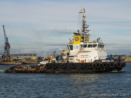
Vessel Britoil 70 IMO: 9581320, MMSI: 565428000 Tug
UTC, 25.87667, 51.64500, course: -1, speed: 0
UTC, 25.87779, 51.64516, course: 50, speed: 0
2026-01-27 18:11:32 UTC, 25.87770, 51.64528, course: 47, speed: 0
Live AIS position:
UTC. Near RAS LAFFAN),
updated 2026-01-27 18:11:32 UTC.
Find the position of the vessel Britoil 70 on the map. The latter are known coordinates and path.
marine traffic ship tracker show on live map
The current position of vessel Britoil 70 is 25.87770 lat / 51.64528 lng. Updated: 2026-01-27 18:11:32 UTCCurrently sailing under the flag of Singapore
Britoil 70 built in 2011 year
Deadweight:
472 tDetails:
Last coordinates of the vessel:
UTC, 25.87804, 51.64547, course: 64, speed: 0UTC, 25.87667, 51.64500, course: -1, speed: 0
UTC, 25.87779, 51.64516, course: 50, speed: 0
2026-01-27 18:11:32 UTC, 25.87770, 51.64528, course: 47, speed: 0