 vesseltracker.com
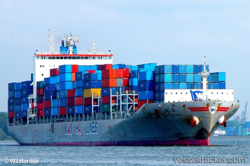
Vessel Wan Hai 509 IMO: 9326421, MMSI: 565653000 Container Ship
UTC, 1.28946, 103.76208, course: 122, speed: 0
UTC, 1.28945, 103.76207, course: 121, speed: 0
2026-01-18 01:32:22 UTC, 1.28944, 103.76207, course: 121, speed: 0
Live AIS position:
UTC. Near PASIR PANJANG Terminal),
updated 2026-01-18 01:32:22 UTC.
Find the position of the vessel Wan Hai 509 on the map. The latter are known coordinates and path.
marine traffic ship tracker show on live map
The current position of vessel Wan Hai 509 is 1.28944 lat / 103.76207 lng. Updated: 2026-01-18 01:32:22 UTCDetails:
Last coordinates of the vessel:
UTC, 1.28941, 103.76207, course: 121, speed: 0UTC, 1.28946, 103.76208, course: 122, speed: 0
UTC, 1.28945, 103.76207, course: 121, speed: 0
2026-01-18 01:32:22 UTC, 1.28944, 103.76207, course: 121, speed: 0