 vesseltracker.com
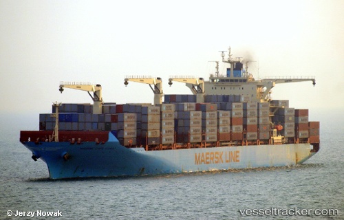
Vessel Maersk Cape Coast IMO: 9525314, MMSI: 566055000 Container Ship
UTC, 6.00454, 1.26609, course: 234, speed: 0
UTC, 6.00504, 1.26575, course: 221, speed: 0
2026-02-02 15:50:13 UTC, 6.00473, 1.26613, course: 235, speed: 0
Live AIS position:
UTC. Near Lome),
updated 2026-02-02 15:50:13 UTC.
Find the position of the vessel Maersk Cape Coast on the map. The latter are known coordinates and path.
marine traffic ship tracker show on live map
The current position of vessel Maersk Cape Coast is 6.00473 lat / 1.26613 lng. Updated: 2026-02-02 15:50:13 UTCDetails:
Last coordinates of the vessel:
UTC, 6.00408, 1.26616, course: 245, speed: 0UTC, 6.00454, 1.26609, course: 234, speed: 0
UTC, 6.00504, 1.26575, course: 221, speed: 0
2026-02-02 15:50:13 UTC, 6.00473, 1.26613, course: 235, speed: 0