 vesseltracker.com
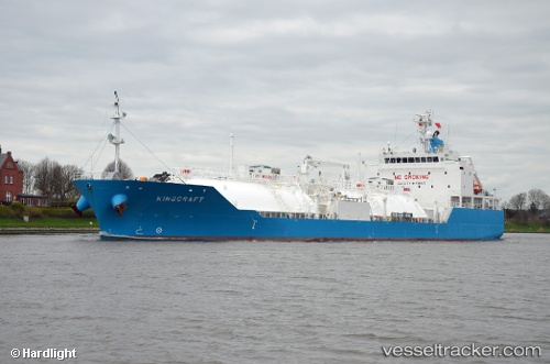
Vessel Kingcraft IMO: 9713648, MMSI: 566477000 Lpg Tanker
UTC, 1.18794, 103.70388, course: 45, speed: 0
UTC, 1.18822, 103.70373, course: 65, speed: 0
2026-02-17 20:16:55 UTC, 1.18758, 103.70455, course: 358, speed: 0.1
Live AIS position:
UTC. Near BUKOM ISLAND),
updated 2026-02-17 20:16:55 UTC.
Find the position of the vessel Kingcraft on the map. The latter are known coordinates and path.
marine traffic ship tracker show on live map
The current position of vessel Kingcraft is 1.18758 lat / 103.70455 lng. Updated: 2026-02-17 20:16:55 UTCDetails:
Last coordinates of the vessel:
UTC, 1.18767, 103.70431, course: 19, speed: 0UTC, 1.18794, 103.70388, course: 45, speed: 0
UTC, 1.18822, 103.70373, course: 65, speed: 0
2026-02-17 20:16:55 UTC, 1.18758, 103.70455, course: 358, speed: 0.1