 vesseltracker.com
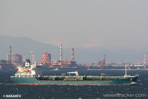
Vessel Alinya IMO: 9401403, MMSI: 567543000 Chemical Oil Products Tanker
UTC, 8.74770, 78.26706, course: 61, speed: 0.1
UTC, 8.74756, 78.26718, course: 52, speed: 0.3
2026-01-27 19:41:46 UTC, 8.74749, 78.26729, course: 46, speed: 0.3
Live AIS position:
UTC. Near Tuticorin),
updated 2026-01-27 19:41:46 UTC.
Find the position of the vessel Alinya on the map. The latter are known coordinates and path.
marine traffic ship tracker show on live map
The current position of vessel Alinya is 8.74749 lat / 78.26729 lng. Updated: 2026-01-27 19:41:46 UTCDetails:
Last coordinates of the vessel:
UTC, 8.74771, 78.26708, course: 61, speed: 0.1UTC, 8.74770, 78.26706, course: 61, speed: 0.1
UTC, 8.74756, 78.26718, course: 52, speed: 0.3
2026-01-27 19:41:46 UTC, 8.74749, 78.26729, course: 46, speed: 0.3