 vesseltracker.com
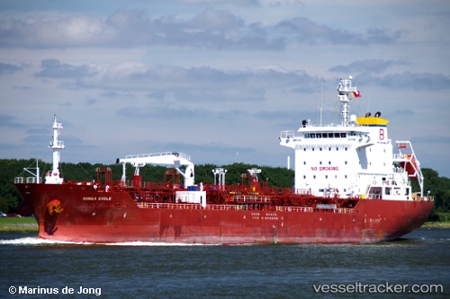
Vessel Anika IMO: 9461714, MMSI: 567552000 Chemical Oil Products Tanker
UTC, 13.11158, 80.30095, course: 17, speed: 0.1
UTC, 13.11160, 80.30098, course: 17, speed: 0
2026-02-03 23:31:11 UTC, 13.11158, 80.30097, course: 16, speed: 0.2
Live AIS position:
UTC. Near Fpo(Sea)/Chennai),
updated 2026-02-03 23:31:11 UTC.
Find the position of the vessel Anika on the map. The latter are known coordinates and path.
marine traffic ship tracker show on live map
The current position of vessel Anika is 13.11158 lat / 80.30097 lng. Updated: 2026-02-03 23:31:11 UTCCurrently sailing under the flag of Thailand
Anika built in 2008 year
Deadweight:
13250 tDetails:
Last coordinates of the vessel:
UTC, 13.11160, 80.30095, course: 17, speed: 0.1UTC, 13.11158, 80.30095, course: 17, speed: 0.1
UTC, 13.11160, 80.30098, course: 17, speed: 0
2026-02-03 23:31:11 UTC, 13.11158, 80.30097, course: 16, speed: 0.2