 vesseltracker.com
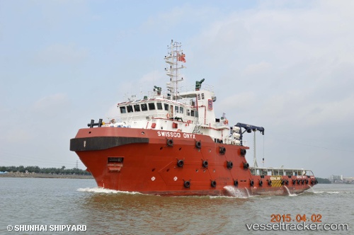
Vessel 572342220 IMO: 9715115, MMSI: 572342220
UTC, 25.27321, 55.26044, course: 202, speed: 0
UTC, 25.27320, 55.26048, course: 201, speed: 0
2026-01-15 08:33:53 UTC, 25.27325, 55.26045, course: 201, speed: 0
Live AIS position:
UTC. Near DUBAI),
updated 2026-01-15 08:33:53 UTC.
Find the position of the vessel 572342220 on the map. The latter are known coordinates and path.
marine traffic ship tracker show on live map
The current position of vessel 572342220 is 25.27325 lat / 55.26045 lng. Updated: 2026-01-15 08:33:53 UTCDetails:
Last coordinates of the vessel:
UTC, 25.27319, 55.26044, course: 202, speed: 0UTC, 25.27321, 55.26044, course: 202, speed: 0
UTC, 25.27320, 55.26048, course: 201, speed: 0
2026-01-15 08:33:53 UTC, 25.27325, 55.26045, course: 201, speed: 0