 vesseltracker.com
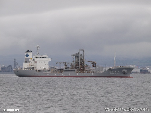
Vessel KENYO IMO: 8915988, MMSI: 572463220 Cement Carrier
UTC, 6.96056, 79.85534, course: 84, speed: 0.2
UTC, 6.96056, 79.85534, course: 84, speed: 0.1
2026-01-18 09:39:37 UTC, 6.96055, 79.85534, course: 84, speed: 0.2
Live AIS position:
UTC. Near Colombo),
updated 2026-01-18 09:39:37 UTC.
Find the position of the vessel KENYO on the map. The latter are known coordinates and path.
marine traffic ship tracker show on live map
The current position of vessel KENYO is 6.96055 lat / 79.85534 lng. Updated: 2026-01-18 09:39:37 UTCCurrently sailing under the flag of Tuvalu
KENYO built in 1990 year
Deadweight:
6366 tDetails:
Last coordinates of the vessel:
UTC, 6.96057, 79.85533, course: 84, speed: 0.1UTC, 6.96056, 79.85534, course: 84, speed: 0.2
UTC, 6.96056, 79.85534, course: 84, speed: 0.1
2026-01-18 09:39:37 UTC, 6.96055, 79.85534, course: 84, speed: 0.2