 vesseltracker.com
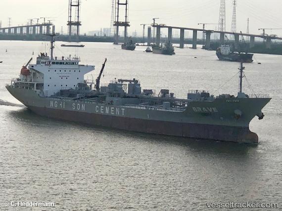
Vessel Brave IMO: 9567831, MMSI: 574001350 Cement Carrier
UTC, 11.55678, 109.19382, course: 212, speed: 14.2
UTC, 11.08242, 108.87122, course: 213, speed: 13.9
2026-02-01 07:56:48 UTC, 10.84349, 108.54065, course: 240, speed: 13.6
Live AIS position:
UTC. 27 nm N of Su Tu Den),
updated 2026-02-01 07:56:48 UTC.
Find the position of the vessel Brave on the map. The latter are known coordinates and path.
marine traffic ship tracker show on live map
The current position of vessel Brave is 10.84349 lat / 108.54065 lng. Updated: 2026-02-01 07:56:48 UTCDetails:
Last coordinates of the vessel:
UTC, 11.97401, 109.36262, course: 192, speed: 13.9UTC, 11.55678, 109.19382, course: 212, speed: 14.2
UTC, 11.08242, 108.87122, course: 213, speed: 13.9
2026-02-01 07:56:48 UTC, 10.84349, 108.54065, course: 240, speed: 13.6