 vesseltracker.com
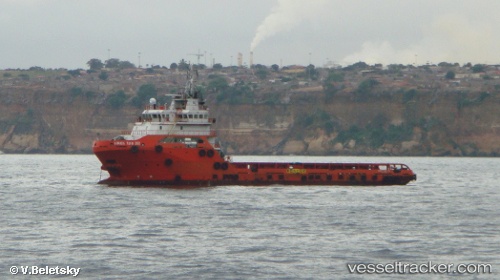
Vessel HAIDUONG 68 IMO: 9568665, MMSI: 574004520
UTC, 10.18633, 98.28286, course: 306, speed: 8.3
UTC, 10.20677, 98.23542, course: 291, speed: 8.6
2026-01-15 18:42:52 UTC, 10.20677, 98.23542, course: 291, speed: 8.6
Live AIS position:
UTC. 28 nm NW of Ranong),
updated 2026-01-15 18:42:52 UTC.
Find the position of the vessel HAIDUONG 68 on the map. The latter are known coordinates and path.
marine traffic ship tracker show on live map
The current position of vessel HAIDUONG 68 is 10.20677 lat / 98.23542 lng. Updated: 2026-01-15 18:42:52 UTCDetails:
Last coordinates of the vessel:
UTC, 10.05109, 98.33813, course: 0, speed: 7.6UTC, 10.18633, 98.28286, course: 306, speed: 8.3
UTC, 10.20677, 98.23542, course: 291, speed: 8.6
2026-01-15 18:42:52 UTC, 10.20677, 98.23542, course: 291, speed: 8.6