 vesseltracker.com
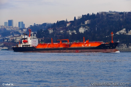
Vessel SEGULL IMO: 9260366, MMSI: 574004790 LPG Tanker
UTC, 40.26667, 19.19667, course: -1, speed: 12
UTC, 39.83056, 19.27560, course: 159, speed: 11.8
2026-03-15 21:24:43 UTC, 39.54333, 19.44167, course: -1, speed: 11
Live Vessel SEGULL Analytics (details, animations, etc.)
Live AIS position: UTC. 14 nm E of Strzelce Wielkie), updated 2026-03-15 21:24:43 UTC.Find the position of the vessel SEGULL on the map. The latter are known coordinates and path.
marine traffic ship tracker show on live map
The current position of vessel SEGULL is 39.54333 lat / 19.44167 lng. Updated: 2026-03-15 21:24:43 UTCCurrently sailing under the flag of Vietnam
SEGULL built in 2002 year
Deadweight:
6017 tDetails:
Last coordinates of the vessel:
UTC, 40.61650, 19.18698, course: 194, speed: 11.2UTC, 40.26667, 19.19667, course: -1, speed: 12
UTC, 39.83056, 19.27560, course: 159, speed: 11.8
2026-03-15 21:24:43 UTC, 39.54333, 19.44167, course: -1, speed: 11