 vesseltracker.com
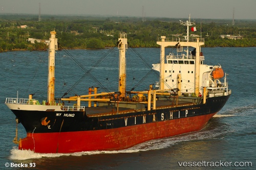
Vessel My Hung IMO: 9269647, MMSI: 574230000 General Cargo Ship
UTC, 33.81333, 132.68500, course: -1, speed: 0
UTC, 33.81361, 132.68639, course: 159, speed: 0
2026-02-19 15:38:05 UTC, 33.81362, 132.68648, course: 159, speed: 0
Live AIS position:
UTC. Near MATSUYAMA),
updated 2026-02-19 15:38:05 UTC.
Find the position of the vessel My Hung on the map. The latter are known coordinates and path.
marine traffic ship tracker show on live map
The current position of vessel My Hung is 33.81362 lat / 132.68648 lng. Updated: 2026-02-19 15:38:05 UTCDetails:
Last coordinates of the vessel:
UTC, 33.81364, 132.68643, course: 159, speed: 0UTC, 33.81333, 132.68500, course: -1, speed: 0
UTC, 33.81361, 132.68639, course: 159, speed: 0
2026-02-19 15:38:05 UTC, 33.81362, 132.68648, course: 159, speed: 0