 vesseltracker.com
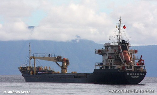
Vessel Dong An Queen IMO: 9548093, MMSI: 574940000 General Cargo Ship
UTC, 1.30081, 104.34586, course: 42, speed: 8
UTC, 1.46080, 104.46813, course: 339, speed: 8.1
2026-02-08 11:53:48 UTC, 1.70574, 104.40700, course: 339, speed: 7.8
Live AIS position:
UTC. 27 nm NE of Tanjung Setapa),
updated 2026-02-08 11:53:48 UTC.
Find the position of the vessel Dong An Queen on the map. The latter are known coordinates and path.
marine traffic ship tracker show on live map
The current position of vessel Dong An Queen is 1.70574 lat / 104.40700 lng. Updated: 2026-02-08 11:53:48 UTCDetails:
Last coordinates of the vessel:
UTC, 1.23467, 103.99349, course: 76, speed: 7.6UTC, 1.30081, 104.34586, course: 42, speed: 8
UTC, 1.46080, 104.46813, course: 339, speed: 8.1
2026-02-08 11:53:48 UTC, 1.70574, 104.40700, course: 339, speed: 7.8