 vesseltracker.com
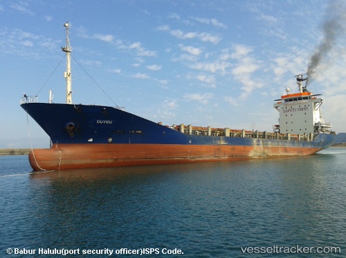
Vessel DUYGU IMO: 9199787, MMSI: 577165000 General Cargo
UTC, 35.70947, -0.64861, course: 271, speed: 0
UTC, 35.70945, -0.64859, course: 271, speed: 0
2026-02-06 05:30:45 UTC, 35.70833, -0.64833, course: -1, speed: 0
Live AIS position:
UTC. Near Oran),
updated 2026-02-06 05:30:45 UTC.
Find the position of the vessel DUYGU on the map. The latter are known coordinates and path.
marine traffic ship tracker show on live map
The current position of vessel DUYGU is 35.70833 lat / -0.64833 lng. Updated: 2026-02-06 05:30:45 UTCCurrently sailing under the flag of Vanuatu
DUYGU built in 2000 year
Deadweight:
7273 tDetails:
Last coordinates of the vessel:
UTC, 35.70833, -0.64833, course: -1, speed: 0UTC, 35.70947, -0.64861, course: 271, speed: 0
UTC, 35.70945, -0.64859, course: 271, speed: 0
2026-02-06 05:30:45 UTC, 35.70833, -0.64833, course: -1, speed: 0