 vesseltracker.com
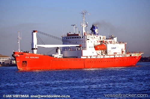
Vessel Sa Agulhas IMO: 7628136, MMSI: 601048000 Research Vessel
UTC, -29.87969, 31.01502, course: -1, speed: 0
UTC, -29.87969, 31.01502, course: -1, speed: 0
2026-02-26 07:33:19 UTC, -29.87969, 31.01502, course: -1, speed: 0
Live AIS position:
UTC. Near Umhlatuzana),
updated 2026-02-26 07:33:19 UTC.
Find the position of the vessel Sa Agulhas on the map. The latter are known coordinates and path.
marine traffic ship tracker show on live map
The current position of vessel Sa Agulhas is -29.87969 lat / 31.01502 lng. Updated: 2026-02-26 07:33:19 UTCCurrently sailing under the flag of South Africa
Sa Agulhas built in 1978 year
Deadweight:
3246 tDetails:
Last coordinates of the vessel:
UTC, -29.87966, 31.01499, course: -1, speed: 0UTC, -29.87969, 31.01502, course: -1, speed: 0
UTC, -29.87969, 31.01502, course: -1, speed: 0
2026-02-26 07:33:19 UTC, -29.87969, 31.01502, course: -1, speed: 0