 vesseltracker.com
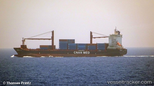
Vessel Tamanrasset IMO: 9760615, MMSI: 605086020 Container Ship
UTC, 35.84171, -0.23370, course: -1, speed: 0.1
UTC, 35.84103, -0.23344, course: -1, speed: 0.1
2026-03-06 13:50:55 UTC, 35.84072, -0.23352, course: 272, speed: 0.4
Live Vessel Tamanrasset Analytics (details, animations, etc.)
Live AIS position: UTC. Near Bettioua), updated 2026-03-06 13:50:55 UTC.Find the position of the vessel Tamanrasset on the map. The latter are known coordinates and path.
marine traffic ship tracker show on live map
The current position of vessel Tamanrasset is 35.84072 lat / -0.23352 lng. Updated: 2026-03-06 13:50:55 UTCCurrently sailing under the flag of Algeria
Details:
Last coordinates of the vessel:
UTC, 35.84133, -0.23342, course: -1, speed: 0.6UTC, 35.84171, -0.23370, course: -1, speed: 0.1
UTC, 35.84103, -0.23344, course: -1, speed: 0.1
2026-03-06 13:50:55 UTC, 35.84072, -0.23352, course: 272, speed: 0.4