 vesseltracker.com
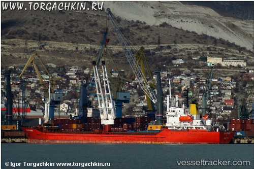
Vessel PRINCESS EMAN IMO: 8129321, MMSI: 620838000 General Cargo Ship
UTC, 38.88278, 26.98888, course: -1, speed: 0
UTC, 38.88338, 26.98927, course: -1, speed: 0
2026-01-28 04:12:43 UTC, 38.88347, 26.99090, course: -1, speed: 0
Live AIS position:
UTC. Near Aliaga),
updated 2026-01-28 04:12:43 UTC.
Find the position of the vessel PRINCESS EMAN on the map. The latter are known coordinates and path.
marine traffic ship tracker show on live map
The current position of vessel PRINCESS EMAN is 38.88347 lat / 26.99090 lng. Updated: 2026-01-28 04:12:43 UTCCurrently sailing under the flag of Comoros
PRINCESS EMAN built in 1988 year
Deadweight:
8490 tDetails:
Last coordinates of the vessel:
UTC, 38.88303, 26.98923, course: -1, speed: 0UTC, 38.88278, 26.98888, course: -1, speed: 0
UTC, 38.88338, 26.98927, course: -1, speed: 0
2026-01-28 04:12:43 UTC, 38.88347, 26.99090, course: -1, speed: 0