 vesseltracker.com
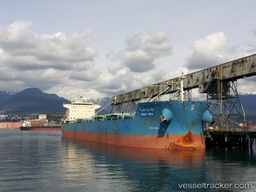
Vessel Wadi Tiba IMO: 9460746, MMSI: 622121409 Bulk Carrier
UTC, 44.15454, 28.64674, course: 98, speed: 0.1
UTC, 44.15449, 28.64673, course: 98, speed: 0
2026-01-14 16:15:47 UTC, 44.15452, 28.64674, course: 98, speed: 0
Live AIS position:
UTC. Near Constanta),
updated 2026-01-14 16:15:47 UTC.
Find the position of the vessel Wadi Tiba on the map. The latter are known coordinates and path.
marine traffic ship tracker show on live map
The current position of vessel Wadi Tiba is 44.15452 lat / 28.64674 lng. Updated: 2026-01-14 16:15:47 UTCCurrently sailing under the flag of Egypt
Wadi Tiba built in 2011 year
Deadweight:
80469 tDetails:
Last coordinates of the vessel:
UTC, 44.15456, 28.64677, course: 98, speed: 0.1UTC, 44.15454, 28.64674, course: 98, speed: 0.1
UTC, 44.15449, 28.64673, course: 98, speed: 0
2026-01-14 16:15:47 UTC, 44.15452, 28.64674, course: 98, speed: 0