 vesseltracker.com
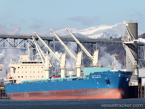
Vessel Wadi Albostan IMO: 9460722, MMSI: 622121410 Bulk Carrier
UTC, 22.74899, 113.64445, course: 342, speed: 0.1
UTC, 22.74899, 113.64486, course: 327, speed: 0
2026-01-26 01:27:45 UTC, 22.74925, 113.64514, course: 318, speed: 0
Live AIS position:
UTC. Near Nansha Pt),
updated 2026-01-26 01:27:45 UTC.
Find the position of the vessel Wadi Albostan on the map. The latter are known coordinates and path.
marine traffic ship tracker show on live map
The current position of vessel Wadi Albostan is 22.74925 lat / 113.64514 lng. Updated: 2026-01-26 01:27:45 UTCDetails:
Last coordinates of the vessel:
UTC, 22.74986, 113.64210, course: 56, speed: 0.4UTC, 22.74899, 113.64445, course: 342, speed: 0.1
UTC, 22.74899, 113.64486, course: 327, speed: 0
2026-01-26 01:27:45 UTC, 22.74925, 113.64514, course: 318, speed: 0