vessel '622121428' IMO: 9763904, vesseltracker.com
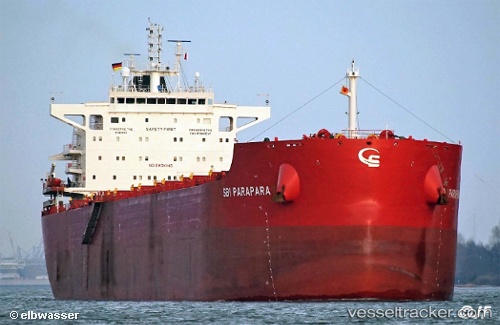
Vessel '622121428' IMO: 9763904,
MMSI: 622121428 callsign: size: x

Find the position of the vessel '622121428' on the map. The latter are known coordinates and path.

marine traffic ship tracker show on live map

The current position of vessel '622121428' is -33.875 lat / -58.4233 lng. Updated: 2025-09-05 23:54:54 UTC
Details:


Last coordinates of the vessel:
UTC, -33.875, -58.4233, course: -1, speed: 0
UTC, -33.8762, -58.4239, course: 184, speed: 0
2025-09-05 23:54:54 UTC, -33.875, -58.4233, course: -1, speed: 0

Track of the vessel in the last 14 days


Most frequent ports a vessels calls at '622121428' (622121428):

Sambu, traffic: 5
Norfolk, traffic: 4
Hampton Roads, traffic: 3
Santos, traffic: 3
Strait Of Gibraltar, traffic: 2
Newport News, traffic: 2
Port Said, traffic: 2
Ras Gharib, traffic: 2
Ayn Sukhnah, traffic: 2
Ra’S Shukhayr, traffic: 2
Bur Ibrahim, traffic: 2
Kakinada, traffic: 2
Singapore, traffic: 2
Little Creek, traffic: 2
Lyttelton, traffic: 1

Link to the map:


Find another ship

'622121428' (622121428) last ports (portcalls and passsages)

Santos | 2022-12-05 02:56:10
Kakinada | 2022-10-23 07:21:07
Kakinada | 2022-10-19 04:54:56
Lyttelton | 2022-09-14 19:16:58
Sambu | 2022-07-27 23:35:31
Santos | 2022-06-20 04:46:48
Santos | 2022-06-16 02:01:57
Newcastle | 2022-04-07 06:15:34
Sambu | 2022-01-24 14:05:44
Sambu | 2022-01-24 13:35:55
Ra’S Shukhayr | 2022-01-07 02:45:53
Ras Gharib | 2022-01-07 01:31:04
Ayn Sukhnah | 2022-01-06 19:09:17
Bur Ibrahim | 2022-01-05 14:00:05
Port Said | 2022-01-05 03:45:34
Strait Of Gibraltar | 2021-12-28 16:15:39
Little Creek | 2021-12-16 09:15:17
Hampton Roads | 2021-12-16 07:45:07
Norfolk | 2021-12-14 01:40:16