 vesseltracker.com
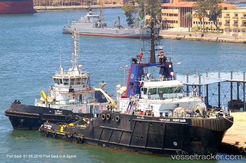
Vessel Port Said IMO: 9305984, MMSI: 622123242 Tug
UTC, 31.25670, 32.30898, course: 36, speed: 0.1
UTC, 31.25669, 32.30896, course: 35, speed: 0.1
2026-03-14 15:26:31 UTC, 31.25665, 32.30897, course: 35, speed: 0.1
Live Vessel Port Said Analytics (details, animations, etc.)
Live AIS position: UTC. Near Port Said), updated 2026-03-14 15:26:31 UTC.Find the position of the vessel Port Said on the map. The latter are known coordinates and path.
marine traffic ship tracker show on live map
The current position of vessel Port Said is 31.25665 lat / 32.30897 lng. Updated: 2026-03-14 15:26:31 UTCDetails:
Last coordinates of the vessel:
UTC, 31.25669, 32.30897, course: 36, speed: 0.1UTC, 31.25670, 32.30898, course: 36, speed: 0.1
UTC, 31.25669, 32.30896, course: 35, speed: 0.1
2026-03-14 15:26:31 UTC, 31.25665, 32.30897, course: 35, speed: 0.1