 vesseltracker.com
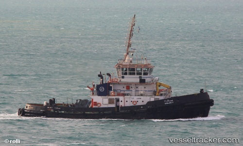
Vessel Salam 6 IMO: 9218349, MMSI: 622123243 Tug
UTC, 29.95280, 32.57593, course: 85, speed: 0.1
UTC, 29.95280, 32.57593, course: 85, speed: 0.1
2026-01-27 17:01:43 UTC, 29.95280, 32.57593, course: 85, speed: 0.1
Live AIS position:
UTC. Near SUEZ PORT),
updated 2026-01-27 17:01:43 UTC.
Find the position of the vessel Salam 6 on the map. The latter are known coordinates and path.
marine traffic ship tracker show on live map
The current position of vessel Salam 6 is 29.95280 lat / 32.57593 lng. Updated: 2026-01-27 17:01:43 UTCCurrently sailing under the flag of Egypt
Salam 6 built in 2007 year
Deadweight:
450 tDetails:
Last coordinates of the vessel:
UTC, 29.95277, 32.57592, course: 86, speed: 0UTC, 29.95280, 32.57593, course: 85, speed: 0.1
UTC, 29.95280, 32.57593, course: 85, speed: 0.1
2026-01-27 17:01:43 UTC, 29.95280, 32.57593, course: 85, speed: 0.1