 vesseltracker.com
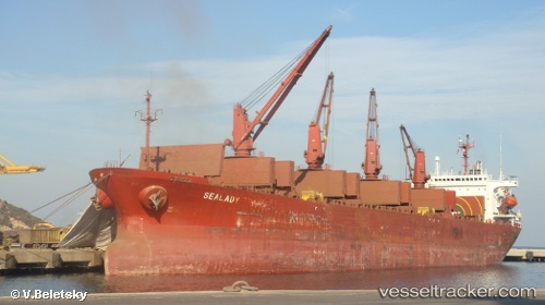
Vessel SEA MERAY IMO: 9104421, MMSI: 630001187 Bulk Carrier
UTC, 44.61691, 37.96154, course: -1, speed: 11.5
UTC, 44.61691, 37.96154, course: -1, speed: 11.5
2026-03-11 10:26:09 UTC, 44.61691, 37.96154, course: -1, speed: 11.5
Live Vessel SEA MERAY Analytics (details, animations, etc.)
Live AIS position: UTC. Near GELENDZHIK), updated 2026-03-11 10:26:09 UTC.Find the position of the vessel SEA MERAY on the map. The latter are known coordinates and path.
marine traffic ship tracker show on live map
The current position of vessel SEA MERAY is 44.61691 lat / 37.96154 lng. Updated: 2026-03-11 10:26:09 UTCCurrently sailing under the flag of Guinea
Details:
Last coordinates of the vessel:
UTC, 44.43312, 37.37555, course: 189, speed: 9UTC, 44.61691, 37.96154, course: -1, speed: 11.5
UTC, 44.61691, 37.96154, course: -1, speed: 11.5
2026-03-11 10:26:09 UTC, 44.61691, 37.96154, course: -1, speed: 11.5