 vesseltracker.com
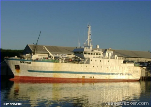
Vessel Ile Bourbon IMO: 9245421, MMSI: 635000300 Fishing Vessel
UTC, -20.93386, 55.28588, course: 197, speed: 0.1
UTC, -20.93386, 55.28588, course: 197, speed: 0.1
2026-01-14 10:49:04 UTC, -20.93386, 55.28588, course: 197, speed: 0.1
Live AIS position:
UTC. Near Le Port),
updated 2026-01-14 10:49:04 UTC.
Find the position of the vessel Ile Bourbon on the map. The latter are known coordinates and path.
marine traffic ship tracker show on live map
The current position of vessel Ile Bourbon is -20.93386 lat / 55.28588 lng. Updated: 2026-01-14 10:49:04 UTCDetails:
Last coordinates of the vessel:
UTC, -20.93386, 55.28588, course: 197, speed: 0.1UTC, -20.93386, 55.28588, course: 197, speed: 0.1
UTC, -20.93386, 55.28588, course: 197, speed: 0.1
2026-01-14 10:49:04 UTC, -20.93386, 55.28588, course: 197, speed: 0.1