 vesseltracker.com
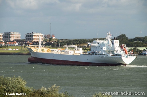
Vessel Orange Wave IMO: 9057123, MMSI: 636009894 Fruit Juice Tanker
UTC, 51.51089, -2.70494, course: 208, speed: 0
UTC, 51.51087, -2.70495, course: 207, speed: 0
2026-02-05 19:28:46 UTC, 51.51089, -2.70494, course: 207, speed: 0
Live AIS position:
UTC. Near Avonmouth),
updated 2026-02-05 19:28:46 UTC.
Find the position of the vessel Orange Wave on the map. The latter are known coordinates and path.
marine traffic ship tracker show on live map
The current position of vessel Orange Wave is 51.51089 lat / -2.70494 lng. Updated: 2026-02-05 19:28:46 UTCCurrently sailing under the flag of Liberia
Orange Wave built in 1993 year
Deadweight:
16700 tDetails:
Last coordinates of the vessel:
UTC, 51.51089, -2.70494, course: 207, speed: 0UTC, 51.51089, -2.70494, course: 208, speed: 0
UTC, 51.51087, -2.70495, course: 207, speed: 0
2026-02-05 19:28:46 UTC, 51.51089, -2.70494, course: 207, speed: 0