 vesseltracker.com
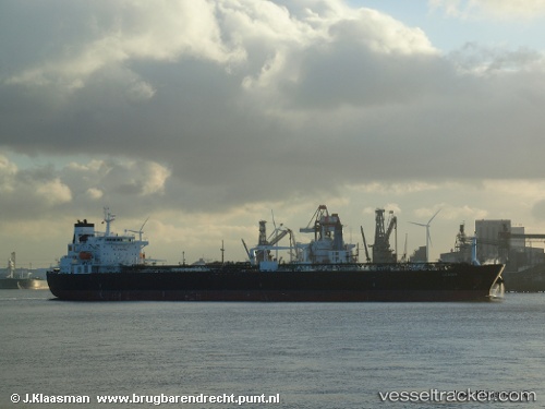
Vessel Leader IMO: 9403542, MMSI: 636013354 Crude Oil Tanker
UTC, -5.87528, 106.00412, course: -1, speed: 0
UTC, -5.87333, 106.00333, course: -1, speed: 0
2026-03-05 03:57:01 UTC, -5.87333, 106.00333, course: -1, speed: 0
Live Vessel Leader Analytics (details, animations, etc.)
Live AIS position: UTC. Near SURALAYA), updated 2026-03-05 03:57:01 UTC.Find the position of the vessel Leader on the map. The latter are known coordinates and path.
marine traffic ship tracker show on live map
The current position of vessel Leader is -5.87333 lat / 106.00333 lng. Updated: 2026-03-05 03:57:01 UTCCurrently sailing under the flag of Liberia
Leader built in 2009 year
Deadweight:
74999 tDetails:
Last coordinates of the vessel:
UTC, -5.87510, 106.00393, course: -1, speed: 0UTC, -5.87528, 106.00412, course: -1, speed: 0
UTC, -5.87333, 106.00333, course: -1, speed: 0
2026-03-05 03:57:01 UTC, -5.87333, 106.00333, course: -1, speed: 0