 vesseltracker.com
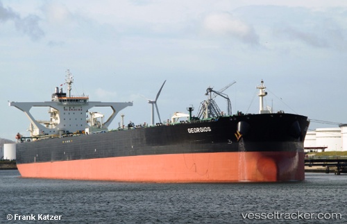
Vessel Georgios IMO: 9389033, MMSI: 636013383 Crude Oil Tanker
UTC, 34.36991, 133.83627, course: 42, speed: 11.4
UTC, 34.43876, 134.07965, course: 100, speed: 13.7
2026-02-01 05:49:07 UTC, 34.52982, 134.74696, course: 66, speed: 14.2
Live AIS position:
UTC. 10 nm NW of Awaji),
updated 2026-02-01 05:49:07 UTC.
Find the position of the vessel Georgios on the map. The latter are known coordinates and path.
marine traffic ship tracker show on live map
The current position of vessel Georgios is 34.52982 lat / 134.74696 lng. Updated: 2026-02-01 05:49:07 UTCDetails:
Last coordinates of the vessel:
UTC, 34.48952, 133.74684, course: 338, speed: 0UTC, 34.36991, 133.83627, course: 42, speed: 11.4
UTC, 34.43876, 134.07965, course: 100, speed: 13.7
2026-02-01 05:49:07 UTC, 34.52982, 134.74696, course: 66, speed: 14.2