 vesseltracker.com
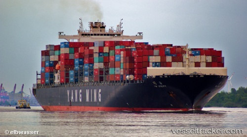
Vessel Ym Utility IMO: 9337470, MMSI: 636013692 Container Ship
UTC, 22.54524, 120.32707, course: 141, speed: 0
UTC, 22.54522, 120.32708, course: 141, speed: 0
2026-01-30 07:24:42 UTC, 22.54521, 120.32707, course: 142, speed: 0
Live AIS position:
UTC. Near Kaohsiung),
updated 2026-01-30 07:24:42 UTC.
Find the position of the vessel Ym Utility on the map. The latter are known coordinates and path.
marine traffic ship tracker show on live map
The current position of vessel Ym Utility is 22.54521 lat / 120.32707 lng. Updated: 2026-01-30 07:24:42 UTCCurrently sailing under the flag of Liberia
Ym Utility built in 2009 year
Deadweight:
103614 tDetails:
Last coordinates of the vessel:
UTC, 22.54521, 120.32707, course: 141, speed: 0UTC, 22.54524, 120.32707, course: 141, speed: 0
UTC, 22.54522, 120.32708, course: 141, speed: 0
2026-01-30 07:24:42 UTC, 22.54521, 120.32707, course: 142, speed: 0