 vesseltracker.com
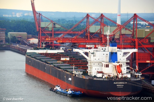
Vessel Alexandra P IMO: 9495387, MMSI: 636013778 Bulk Carrier
UTC, 20.81913, 86.96983, course: 199, speed: 0
UTC, 20.81917, 86.96980, course: 199, speed: 0.1
2026-02-21 12:18:15 UTC, 20.81917, 86.96980, course: 199, speed: 0
Live AIS position:
UTC. Near DHAMRA),
updated 2026-02-21 12:18:15 UTC.
Find the position of the vessel Alexandra P on the map. The latter are known coordinates and path.
marine traffic ship tracker show on live map
The current position of vessel Alexandra P is 20.81917 lat / 86.96980 lng. Updated: 2026-02-21 12:18:15 UTCDetails:
Last coordinates of the vessel:
UTC, 20.81912, 86.96978, course: 199, speed: 0UTC, 20.81913, 86.96983, course: 199, speed: 0
UTC, 20.81917, 86.96980, course: 199, speed: 0.1
2026-02-21 12:18:15 UTC, 20.81917, 86.96980, course: 199, speed: 0