 vesseltracker.com
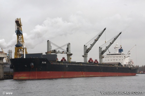
Vessel Ilia IMO: 9490650, MMSI: 636014299 Bulk Carrier
UTC, 17.88705, -102.17928, course: 274, speed: 0.2
UTC, 17.88677, -102.17827, course: 276, speed: 0
2026-02-03 04:01:44 UTC, 17.88688, -102.17827, course: 276, speed: 0.1
Live AIS position:
UTC. Near Lazaro Cardenas),
updated 2026-02-03 04:01:44 UTC.
Find the position of the vessel Ilia on the map. The latter are known coordinates and path.
marine traffic ship tracker show on live map
The current position of vessel Ilia is 17.88688 lat / -102.17827 lng. Updated: 2026-02-03 04:01:44 UTCCurrently sailing under the flag of Liberia
Ilia built in 2009 year
Deadweight:
57970 tDetails:
Last coordinates of the vessel:
UTC, 17.88778, -102.17938, course: 259, speed: 0.1UTC, 17.88705, -102.17928, course: 274, speed: 0.2
UTC, 17.88677, -102.17827, course: 276, speed: 0
2026-02-03 04:01:44 UTC, 17.88688, -102.17827, course: 276, speed: 0.1