 vesseltracker.com
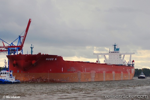
Find the position of the vessel Hugo N on the map. The latter are known coordinates and path.
marine traffic ship tracker show on live map
The current position of vessel Hugo N is -20.7082 lat / -38.9845 lng. Updated: 2025-02-22 12:30:23 UTCPort of registry:
Monrovia (capital city of Liberia)Speed:
14.5 knotPayload_mass:
297088 tonneGross tonnage:
151448Service entry:
2011-01-01T00:00:00ZDetails:
Last coordinates of the vessel:
UTC, -20.5593, -39.474, course: 111, speed: 9.2UTC, -20.6356, -39.2259, course: 106, speed: 9.2
UTC, -20.673, -39.1051, course: 104, speed: 8.9
2025-02-22 12:30:23 UTC, -20.7082, -38.9845, course: 104, speed: 8.8