 vesseltracker.com
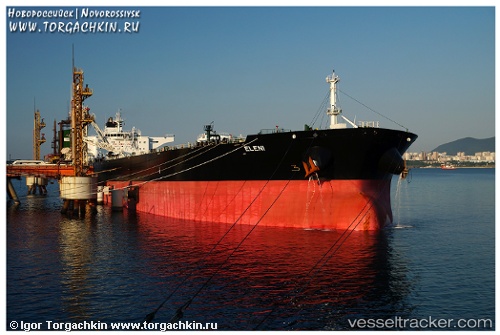
Vessel ELENI IMO: 9432062, MMSI: 636014502 Crude Oil Tanker
UTC, 25.03174, 57.27893, course: 123, speed: 12.5
UTC, 24.90885, 57.50132, course: 119, speed: 12.8
2026-01-17 06:19:13 UTC, 24.68261, 57.96786, course: 114, speed: 13.2
Live AIS position:
UTC. 57 nm NE of AL SUWAIQ),
updated 2026-01-17 06:19:13 UTC.
Find the position of the vessel ELENI on the map. The latter are known coordinates and path.
marine traffic ship tracker show on live map
The current position of vessel ELENI is 24.68261 lat / 57.96786 lng. Updated: 2026-01-17 06:19:13 UTCCurrently sailing under the flag of Liberia
ELENI built in 2011 year
Deadweight:
149999 tDetails:
Last coordinates of the vessel:
UTC, 25.13870, 57.03125, course: 118, speed: 12.7UTC, 25.03174, 57.27893, course: 123, speed: 12.5
UTC, 24.90885, 57.50132, course: 119, speed: 12.8
2026-01-17 06:19:13 UTC, 24.68261, 57.96786, course: 114, speed: 13.2