 vesseltracker.com
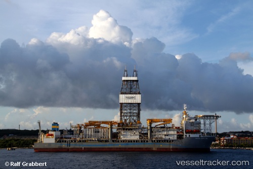
Vessel Pacific Santa Ana IMO: 9499917, MMSI: 636014748 Drilling Ship
UTC, 5.20205, -4.04155, course: 200, speed: 0
UTC, 5.20186, -4.04155, course: 194, speed: 0.1
2026-01-19 10:12:00 UTC, 5.20173, -4.04166, course: 205, speed: 0.1
Live AIS position:
UTC. Near Vridi),
updated 2026-01-19 10:12:00 UTC.
Find the position of the vessel Pacific Santa Ana on the map. The latter are known coordinates and path.
marine traffic ship tracker show on live map
The current position of vessel Pacific Santa Ana is 5.20173 lat / -4.04166 lng. Updated: 2026-01-19 10:12:00 UTCCurrently sailing under the flag of Liberia
Pacific Santa Ana built in 2011 year
Deadweight:
58830 tDetails:
Last coordinates of the vessel:
UTC, 5.20209, -4.04158, course: 200, speed: 0.1UTC, 5.20205, -4.04155, course: 200, speed: 0
UTC, 5.20186, -4.04155, course: 194, speed: 0.1
2026-01-19 10:12:00 UTC, 5.20173, -4.04166, course: 205, speed: 0.1