 vesseltracker.com
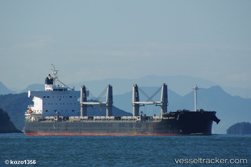
Vessel Solar Africa IMO: 9426128, MMSI: 636014894 Bulk Carrier
UTC, 14.44333, -80.95667, course: -1, speed: 13
UTC, 14.85833, -80.97167, course: -1, speed: 12
2026-02-27 19:37:57 UTC, 15.23167, -81.07000, course: -1, speed: 12
Live AIS position:
UTC. 152 nm NE of Puerto Cabezas),
updated 2026-02-27 19:37:57 UTC.
Find the position of the vessel Solar Africa on the map. The latter are known coordinates and path.
marine traffic ship tracker show on live map
The current position of vessel Solar Africa is 15.23167 lat / -81.07000 lng. Updated: 2026-02-27 19:37:57 UTCCurrently sailing under the flag of Liberia
Solar Africa built in 2011 year
Deadweight:
58064 tDetails:
Last coordinates of the vessel:
UTC, 14.03167, -80.92500, course: -1, speed: 12UTC, 14.44333, -80.95667, course: -1, speed: 13
UTC, 14.85833, -80.97167, course: -1, speed: 12
2026-02-27 19:37:57 UTC, 15.23167, -81.07000, course: -1, speed: 12