 vesseltracker.com
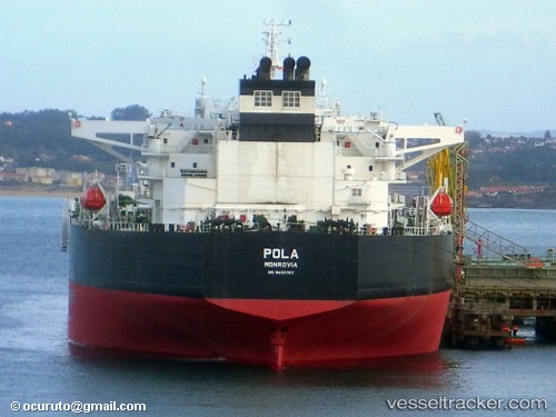
Vessel Pola IMO: 9493767, MMSI: 636015014 Crude Oil Tanker
UTC, 18.93552, 72.69232, course: 349, speed: 0
UTC, 18.93735, 72.69425, course: 287, speed: 0.1
2026-01-31 13:42:08 UTC, 18.93950, 72.69315, course: 230, speed: 0
Live AIS position:
UTC. Near Air Parcel Sorting Office/Mumbai),
updated 2026-01-31 13:42:08 UTC.
Find the position of the vessel Pola on the map. The latter are known coordinates and path.
marine traffic ship tracker show on live map
The current position of vessel Pola is 18.93950 lat / 72.69315 lng. Updated: 2026-01-31 13:42:08 UTCCurrently sailing under the flag of Liberia
Pola built in 2011 year
Deadweight:
149996 tDetails:
Last coordinates of the vessel:
UTC, 18.93616, 72.69062, course: 39, speed: 0.1UTC, 18.93552, 72.69232, course: 349, speed: 0
UTC, 18.93735, 72.69425, course: 287, speed: 0.1
2026-01-31 13:42:08 UTC, 18.93950, 72.69315, course: 230, speed: 0