 vesseltracker.com
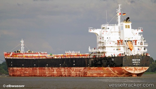
Vessel Nestor IMO: 9493913, MMSI: 636015048 Bulk Carrier
UTC, -34.72051, -57.84257, course: 102, speed: 0
UTC, -34.72043, -57.84255, course: 104, speed: 0
2026-02-16 19:33:29 UTC, -34.72095, -57.84273, course: 89, speed: 0
Live AIS position:
UTC. Near La Plata),
updated 2026-02-16 19:33:29 UTC.
Find the position of the vessel Nestor on the map. The latter are known coordinates and path.
marine traffic ship tracker show on live map
The current position of vessel Nestor is -34.72095 lat / -57.84273 lng. Updated: 2026-02-16 19:33:29 UTCDetails:
Last coordinates of the vessel:
UTC, -34.71993, -57.84216, course: 125, speed: 0.1UTC, -34.72051, -57.84257, course: 102, speed: 0
UTC, -34.72043, -57.84255, course: 104, speed: 0
2026-02-16 19:33:29 UTC, -34.72095, -57.84273, course: 89, speed: 0