 vesseltracker.com
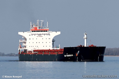
Vessel Am Tubarao IMO: 9593488, MMSI: 636015171 Bulk Carrier
UTC, 45.29913, 36.45454, course: 236, speed: 3
UTC, 45.29913, 36.45454, course: 236, speed: 3
2026-02-20 07:52:58 UTC, 45.24193, 36.54100, course: 202, speed: 54.9
Live AIS position:
UTC. Near KOMYSH BURUNSKA),
updated 2026-02-20 07:52:58 UTC.
Find the position of the vessel Am Tubarao on the map. The latter are known coordinates and path.
marine traffic ship tracker show on live map
The current position of vessel Am Tubarao is 45.24193 lat / 36.54100 lng. Updated: 2026-02-20 07:52:58 UTCCurrently sailing under the flag of Liberia
Am Tubarao built in 2011 year
Deadweight:
93225 tDetails:
Last coordinates of the vessel:
UTC, 45.30573, 36.45392, course: 229, speed: 6.7UTC, 45.29913, 36.45454, course: 236, speed: 3
UTC, 45.29913, 36.45454, course: 236, speed: 3
2026-02-20 07:52:58 UTC, 45.24193, 36.54100, course: 202, speed: 54.9