 vesseltracker.com
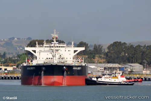
Vessel Aqualiberty IMO: 9592226, MMSI: 636015174 Crude Oil Tanker
UTC, 49.46976, 0.13148, course: 284, speed: 0
UTC, 49.46978, 0.13149, course: 284, speed: 0
2026-02-26 10:02:04 UTC, 49.46980, 0.13145, course: 283, speed: 0
Live AIS position:
UTC. Near Le Havre),
updated 2026-02-26 10:02:04 UTC.
Find the position of the vessel Aqualiberty on the map. The latter are known coordinates and path.
marine traffic ship tracker show on live map
The current position of vessel Aqualiberty is 49.46980 lat / 0.13145 lng. Updated: 2026-02-26 10:02:04 UTCDetails:
Last coordinates of the vessel:
UTC, 49.46977, 0.13142, course: 283, speed: 0.1UTC, 49.46976, 0.13148, course: 284, speed: 0
UTC, 49.46978, 0.13149, course: 284, speed: 0
2026-02-26 10:02:04 UTC, 49.46980, 0.13145, course: 283, speed: 0