 vesseltracker.com
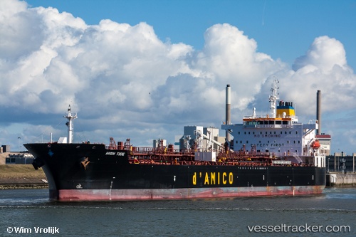
Vessel High Tide IMO: 9455820, MMSI: 636015337 Chemical Oil Products Tanker
UTC, 14.02526, 73.63775, course: 159, speed: 13.1
UTC, 13.51633, 73.85136, course: 163, speed: 13.1
2026-02-08 14:23:25 UTC, 13.06510, 74.02778, course: 157, speed: 12.6
Live AIS position:
UTC. 46 nm W of Synefra-SEZ/Udupi),
updated 2026-02-08 14:23:25 UTC.
Find the position of the vessel High Tide on the map. The latter are known coordinates and path.
marine traffic ship tracker show on live map
The current position of vessel High Tide is 13.06510 lat / 74.02778 lng. Updated: 2026-02-08 14:23:25 UTCDetails:
Last coordinates of the vessel:
UTC, 14.42500, 73.47333, course: -1, speed: 13UTC, 14.02526, 73.63775, course: 159, speed: 13.1
UTC, 13.51633, 73.85136, course: 163, speed: 13.1
2026-02-08 14:23:25 UTC, 13.06510, 74.02778, course: 157, speed: 12.6