 vesseltracker.com
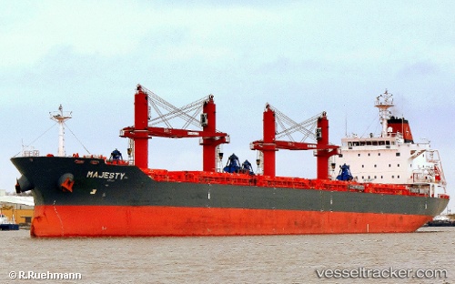
Vessel Majesty IMO: 9442574, MMSI: 636015357 Bulk Carrier
UTC, 8.30411, 109.00732, course: 168, speed: 12.9
UTC, 8.10832, 109.03925, course: 168, speed: 12.5
2026-01-15 19:32:46 UTC, 7.95401, 109.04183, course: 182, speed: 12.1
Live AIS position:
UTC. 37 nm SE of Dai Hung (Tandem Load)),
updated 2026-01-15 19:32:46 UTC.
Find the position of the vessel Majesty on the map. The latter are known coordinates and path.
marine traffic ship tracker show on live map
The current position of vessel Majesty is 7.95401 lat / 109.04183 lng. Updated: 2026-01-15 19:32:46 UTCDetails:
Last coordinates of the vessel:
UTC, 8.43054, 108.98997, course: 174, speed: 12.8UTC, 8.30411, 109.00732, course: 168, speed: 12.9
UTC, 8.10832, 109.03925, course: 168, speed: 12.5
2026-01-15 19:32:46 UTC, 7.95401, 109.04183, course: 182, speed: 12.1