 vesseltracker.com
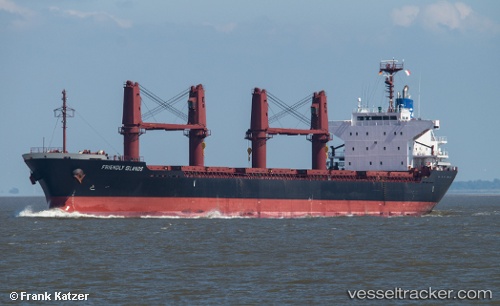
Vessel Friendly Islands IMO: 9615042, MMSI: 636015708 Bulk Carrier
UTC, -32.24061, 115.75527, course: 13, speed: 0
UTC, -32.24062, 115.75524, course: 13, speed: 0
2026-02-27 18:00:49 UTC, -32.24068, 115.75526, course: 14, speed: 0
Live AIS position:
UTC. Near Kwinana),
updated 2026-02-27 18:00:49 UTC.
Find the position of the vessel Friendly Islands on the map. The latter are known coordinates and path.
marine traffic ship tracker show on live map
The current position of vessel Friendly Islands is -32.24068 lat / 115.75526 lng. Updated: 2026-02-27 18:00:49 UTCCurrently sailing under the flag of Liberia
Friendly Islands built in 2012 year
Deadweight:
28387 tDetails:
Last coordinates of the vessel:
UTC, -32.24064, 115.75528, course: -1, speed: 0UTC, -32.24061, 115.75527, course: 13, speed: 0
UTC, -32.24062, 115.75524, course: 13, speed: 0
2026-02-27 18:00:49 UTC, -32.24068, 115.75526, course: 14, speed: 0