 vesseltracker.com
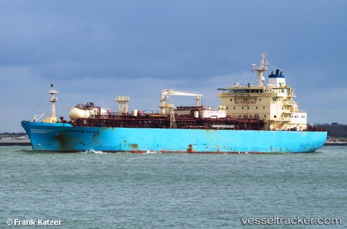
Vessel Navigator Galaxy IMO: 9536363, MMSI: 636015946 Lpg Tanker
UTC, 8.90756, -57.06413, course: 126, speed: 9.8
UTC, 8.72014, -56.72388, course: 124, speed: 9.8
2026-03-24 07:35:14 UTC, 8.60528, -56.51829, course: 123, speed: 9.7
Live Vessel Navigator Galaxy Analytics (details, animations, etc.)
Live AIS position: UTC. 141 nm NE of Enmore), updated 2026-03-24 07:35:14 UTC.Find the position of the vessel Navigator Galaxy on the map. The latter are known coordinates and path.
marine traffic ship tracker show on live map
The current position of vessel Navigator Galaxy is 8.60528 lat / -56.51829 lng. Updated: 2026-03-24 07:35:14 UTCDetails:
Last coordinates of the vessel:
UTC, 9.01762, -57.24157, course: 129, speed: 9.6UTC, 8.90756, -57.06413, course: 126, speed: 9.8
UTC, 8.72014, -56.72388, course: 124, speed: 9.8
2026-03-24 07:35:14 UTC, 8.60528, -56.51829, course: 123, speed: 9.7