 vesseltracker.com
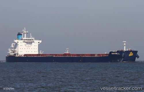
Vessel Omiros L IMO: 9597393, MMSI: 636016152 Bulk Carrier
UTC, 49.03458, -123.65118, course: 120, speed: 0.1
UTC, 49.03426, -123.65122, course: 118, speed: 0
2026-02-17 11:27:28 UTC, 49.03356, -123.65117, course: 100, speed: 0.1
Live AIS position:
UTC. Near Thetis Island),
updated 2026-02-17 11:27:28 UTC.
Find the position of the vessel Omiros L on the map. The latter are known coordinates and path.
marine traffic ship tracker show on live map
The current position of vessel Omiros L is 49.03356 lat / -123.65117 lng. Updated: 2026-02-17 11:27:28 UTCDetails:
Last coordinates of the vessel:
UTC, 49.03479, -123.65078, course: 125, speed: 0UTC, 49.03458, -123.65118, course: 120, speed: 0.1
UTC, 49.03426, -123.65122, course: 118, speed: 0
2026-02-17 11:27:28 UTC, 49.03356, -123.65117, course: 100, speed: 0.1