 vesseltracker.com
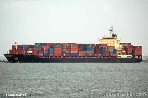
Vessel Thorstar IMO: 9253002, MMSI: 636017016 Container Ship
UTC, 1.36017, 103.54598, course: 344, speed: 0
UTC, 1.36016, 103.54599, course: 344, speed: 0
2026-01-16 01:32:01 UTC, 1.36016, 103.54598, course: 343, speed: 0
Live AIS position:
UTC. Near Tanjong Bin),
updated 2026-01-16 01:32:01 UTC.
Find the position of the vessel Thorstar on the map. The latter are known coordinates and path.
marine traffic ship tracker show on live map
The current position of vessel Thorstar is 1.36016 lat / 103.54598 lng. Updated: 2026-01-16 01:32:01 UTCCurrently sailing under the flag of Liberia
Thorstar built in 2003 year
Deadweight:
39425 tDetails:
Last coordinates of the vessel:
UTC, 1.36014, 103.54596, course: 343, speed: 0UTC, 1.36017, 103.54598, course: 344, speed: 0
UTC, 1.36016, 103.54599, course: 344, speed: 0
2026-01-16 01:32:01 UTC, 1.36016, 103.54598, course: 343, speed: 0