 vesseltracker.com
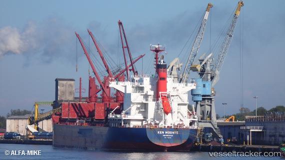
Vessel Ken Moonys IMO: 9748382, MMSI: 636017305 Bulk Carrier
UTC, 29.59049, 48.79763, course: 125, speed: 0.1
UTC, 29.59060, 48.79765, course: 130, speed: 0.1
2026-01-31 08:14:06 UTC, 29.59110, 48.79854, course: 162, speed: 0.1
Live AIS position:
UTC. Near Basrah Oil Terminal),
updated 2026-01-31 08:14:06 UTC.
Find the position of the vessel Ken Moonys on the map. The latter are known coordinates and path.
marine traffic ship tracker show on live map
The current position of vessel Ken Moonys is 29.59110 lat / 48.79854 lng. Updated: 2026-01-31 08:14:06 UTCDetails:
Last coordinates of the vessel:
UTC, 29.59029, 48.79771, course: 119, speed: 0.2UTC, 29.59049, 48.79763, course: 125, speed: 0.1
UTC, 29.59060, 48.79765, course: 130, speed: 0.1
2026-01-31 08:14:06 UTC, 29.59110, 48.79854, course: 162, speed: 0.1